Originally published at Stillwater Historians, April 11, 2012.
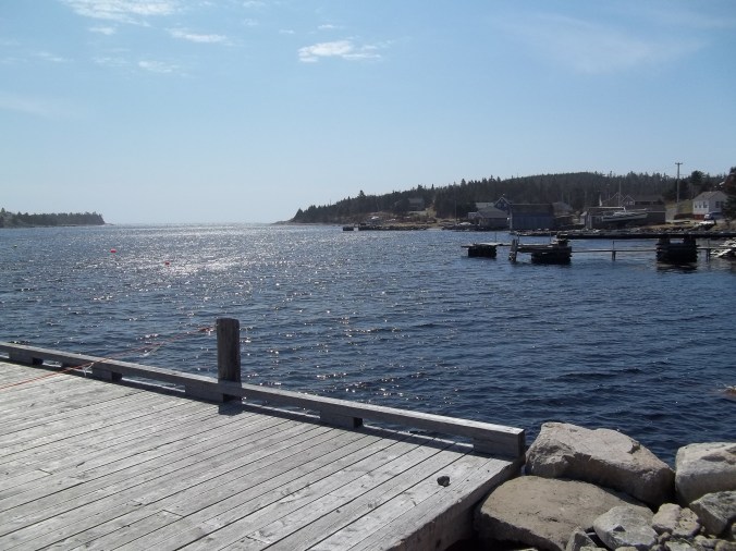
View from the community wharf at Ketch Harbour, Nova Scotia
As promised in an earlier post, Problems of Place, I have been rethinking some of my research through more local lenses, and thinking about GIS as a means of organizing myself for that shift. Our recent conversations about digital history have further fostered this thinking, so I wanted here to experiment with an exploration that matches up some archival work with some present day (actually yesterday) ground-truthing of a tiny slice of coastal Nova Scotia.
When I was here in Halifax several years back gathering material for a paper I presented at ASEH in Victoria, I stumbled upon a wealth of petitions from fishermen—but was, at the time, more interested in seizure cases and Vice Admiralty court records from the 1870s and 80s. I scribbled some notes from a set of petitions from Ketch Harbour and Portuguese Cove in the 1830s and 40s—not expecting that 8 years later I’d be living in Halifax and dedicating considerable chunks of time to following up on stray notes collected by an even more naïve version of me! Since I’ve been back I’ve found that relative to their size, the communities between Halifax and Sambro, along the eastern coast of the Chebucto peninsula and just eastward of St Margaret’s and Mahone Bays, generated an enormous number of petitions respecting their local fisheries.
In 1836 the fishermen of Ketch Harbour expressed their frustration to the Lieutenant Governor that seine fishermen from Portuguese Cove and Duncan’s Cove were encroaching upon their territory and interfering with their efforts to take fish by nets. In response to their appeal, a commission was sent to investigate the conflict and seek resolutions between the stakeholders. Three judges and assemblymen came down from Halifax to survey the situation and gather information from the fishermen as to the nature of their conflict. The matter was then submitted to arbitration, the result of which was a law passed by the Sessions of Halifax County for the management of the fisheries of this small part of the Nova Scotia coast. It created a lottery system, or rather codified one already in place, that designated to seine owners the time, place, and order in which they could haul their seines–so that multiple users could coexist in limited space. Further it restricted the net fishing to those times and places where it could not run afoul of the seiners. It also effectively expanded a jurisdiction—extending a system unique to Portuguese Cove to the various settlements along the shore between there and Ketch Harbour.

Duncan’s Cove, Nova Scotia
Unfortunately, this did not settle the matter. The very next year Ketch Harbour fishermen reported that certain men from Portuguese Cove violated the law pretty much from the moment of its inception. Additionally, they sought to impose restrictions on the net fishery, mandating that 30 to 35 fathoms be allowed between the nets to prevent them becoming entangled with one another, which caused costly losses in both fish and fishing gear. Worse though, in the 1840s, Ketch Harbour and Duncan’s Cove men were complaining that, while a degree of rapprochement had been achieved with Portuguese Cove, their system was now coming under attack by fishermen from other parts of the region. In 1852 fishermen from Sambro—only a few miles to the southwest—began to complain that the residents of the coast from Portuguese Cove to Ketch Harbour would not allow them to enter their lottery. They referred to this system as the only regulations that had been set down for the management of the mackerel fishery in the area. There is an implication in their petition that in addition to being prevented from entering the lottery on the east side of the peninsula, the resident fishermen had also been vigilant in expelling them from the “vacant places”—those fishing spots not specifically allocated by lottery, but still valuable to the health of the local industry and its marine ecosystem.
In an 1864 letter to John Tobin, an assemblyman well versed in fisheries matters (who may actually have been one of the two arbitrators of 1836—yet to confirm if it was the same man or perhaps a son), Francis Munro of Portuguese Cove made a plain-spoken but compelling case for local control of marine resources. He pointed out that there was a movement afoot to crowd out the net fishermen in favor of seine fishing through the passage of laws that privileged the operation of the latter over the former. Munro pointed out that the size of these coves precluded the inhabitants from growing into other sectors of the fishing business—and that net and seine fishermen had been coexisting there for some time. Geography had limited them to making the best use of their local grounds. But a commission that was framing laws for the County Sessions was looking to impose greater restrictions on small scale net fishermen, including expanding the space between nets to as much as 60 or 65 fathoms (a fathom is six feet and none of these coves are really all that big across), and limiting their use to the night time when they would not interfere with the seine fishing. Munro argued that the lottery system of Portuguese Cove had been in place amongst the residents for as much as sixty years, and codified in local law for almost thirty. To subject the local fishermen to laws made by special interests in another place was both unfair and potentially ruinous to their livelihoods.

Turbulant swells and exposed granite near Duncan’s Cove indicate irregular, rocky bottom–often good for fish, but dangerous for larger craft, especially those lacking local knowledge and detailed charts.
In 1852 Portuguese Cove had also been one of a multitude of ports to protest against the encroachments of American fishermen. While they may have been equipped to keep the fishermen from nearby Pennant and Sambro at bay, the Gloucester fleet was more than their little boats could handle. They joined a chorus of colonial fishermen calling upon the Nova Scotian government and the Royal Navy to intervene in protecting their fishing grounds from illegal encroachments by foreigners. Though their suggestion to equip fishing vessels with armed officers so as to split time between fishing and enforcing regulations seems both practically preposterous and a monumental conflict of interests, it does have a curious flavor of the vigilante spirit that had so long been central to protecting marine resources.
Eager to see these little places that had been so outspoken in the protection of their fishing interests, I fired up the truck for the first time in weeks and, brand new digital camera in hand, set off for Portuguese Cove and Ketch Harbour, which are only a couple miles apart, and not twenty minutes drive from Halifax. Today, both places, and the several localities nearby, are a mix of modest homes and upscale waterfront properties—not unlike parts of the midcoast region of Maine. And, also like Maine, it appears that much of the fishing industry has been given over to lobstering. Portuguese Cove is but a tiny inlet, really little more than a notch in the coast, which affords very little protection, particularly from easterly and southeasterly winds that accompany rough weather. Duncan’s Cove is also very small. Ketch Harbour is larger and affords greater shelter and, it would appear, access to somewhat larger vessels–but would hardly compel the same traffic as nearby Sambro or Halifax.
I drove into Duncan’s Cove and picked up a trail that led me southward towards the mouth of Ketch Harbour. As a sea kayak guide I was tuned in to the pattern of the swells that came ashore as indicative of irregular bottom and dangerous shoals. That, mixed with the nutrient rich waters washing out of Halifax Harbour and Bedford Basin with the tides could make for very rich fishing for those with the local knowledge to pursue it safely. And the limited reach of the small craft used by the local fishermen would have meant that they would have understood, over time, the eccentricities of their local waters very well and known what areas needed to be most enthusiastically protected against encroachment by neighboring communities and countries.

So much evidence for studying the history of coastal space. From patterns of erosion and striations in the granite to a fisherman’s lost glove washed ashore, to a stone cairn built by walkers along a coastal path, to the lighthouse on the hill in the distance–and the mansion to the right of it!
Clearly there is a great deal more to do here. A couple hours with hiking boots, a camera, and some attention to detail must now be married to some scrutiny of geological and topographical maps and nautical charts and some additional archival work, followed by another trip out to the trail to look for the additional clues that the present landscape may be able to give me about the past. When you study policy it can be easy to forget that, while regulations may be applied to multiple places as jurisdictions over time grow ever larger, the experience of that policy is a function of many factors. Because my work centers heavily on the enforcement of management institutions (and therefore, very often, conflict), the interests and personalities of individual people and the natural characteristics of individual places become more central to the story, adding, I hope, greater nuance and texture.
